The Nomads Outdoors Group Inc.
Powered by
Past events
All events
Past events
Feb
24
2024
Past Event
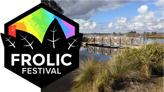
The Nomads Ballarat Frolic Festival Community Walk
Wendouree Station
10:00 – 17:00
Enjoy a walk through beautiful Ballarat parks between Wendouree Station and central Ballarat, explore some fascinating Australian history, and join the Frolic Festival picnic celebration, near Ballarat Station.
GRADE | LENGTH | TYPE: Moderate 10 km point-to-point walk with public transport connections.
ACTIVITY DESCRIPTION: Starting from the Wendouree V/Line Station, we'll walk via the Botanic Gardens and Lake Wendouree to visit the Ballarat Old Cemetery, then some historic sites in Lydiard Street, before finishing up at the Frolic Festival picnic in Alfred Deakin Place.
The event is designed to enable easy public transport access to and from Melbourne.
BOOKING: By Friday 22nd February. To register click on Get Tickets.
Unsure if you've already booked? Click View my bookings.
FURTHER INFORMATION: Ballarat Frolic Festival (frolicfestival.org).
MEETING TIME | LOCATION: 10am at the Wendouree V/Line Station, cnr Learmonth Rd and Gillies St, Wendouree (Ballarat).
MAP REFERENCE: Melway map X909 grid A11 | Google map maps.app.goo.gl/DNq5VmqB3Hu5YZr49.
DISTANCE | TIME FROM GPO: 122 km, approximately 1 hour 40 minutes via M8 to Wendouree, exiting onto Gillies St N/C307, which takes you to the station.
PUBLIC TRANSPORT: The Ararat service that departs from Southern Cross at 8:14am arrives at Wendouree at 9:51am. For the return to Melbourne, services depart from Ballarat Station at 2:20pm, 3:20pm, 4:20pm, 5:20pm, 6:20pm, 7:20pm and 9:28pm. Capped fares apply on weekends and public holidays if using myki money - $7:20 Full or $3.60 Concession/Seniors.
FOOD: Carry lunch, snacks and a litre of water.
APPAREL | FOOTWEAR: Comfortable walking boots/shoes and dress according to the weather forecast. Ballarat can be several degrees cooler than Melbourne.
LEADER: Don V. | Email LeaderDonV.thenomadsinc@mail.tidyhq.com if you have any questions.
Members can access leader contact details under Members | Leader Contacts when logged in to the website.
HOME BACK TO LIST OF EVENTS MEMBERSHIPS
Feb
18
2024
Past Event
Naturist Mixed Walk, Carrolls Spring & the Upper Werribee River
At the Pergola in the Community Park
10:15 – 16:00
A very pleasant place for a naturist walk amongst the tall trees of the Wombat State Forest and along the banks of the upper Werribee River, with a short detour to visit and taste the water from the Carrolls Mineral Spring. If it's hot there are waterholes for cooling off.
GRADE | LENGTH | TYPE: Easy to medium 7km circuit walk. Although we mostly walk along the banks of the river there are a few ups and downs where the track climbs over cliff tops beside the river.
ACTIVITY DESCRIPTION: This event is for naturists. Enjoy a naked hike along the banks of the upper reaches of the Werribee River. At times the small track deviates into the open forest to avoid cliffs along the river bank. Along the way we will visit Carrolls Spring, one of the southernmost springs in the Hepburn-Daylesford area. The water flow can be a bit slow but it tastes quite good. Lunch will be on the grassed and shady river bank. If the day is hot we can cool off in one of the river waterholes or where the water cascades over the rocks. (Maybe include a pair of jocks just in case there are campers on the bank near the cascades, hopefully not).
BOOKING: Preferably by Friday 16th February. To register click on Get Tickets.
Unsure if you've already booked? Click View my bookings.
MEETING TIME | LOCATION: 10.15am for coffee and catch up at the Pergola in the small Community Park at 131 Inglis St, Ballan (the main street). It is next to The Ballan Takeaway shop. The best parking is around the corner in Fisken St. There are a few coffee shops nearby. Toilets are located at the rear of the Community Park. (Optus mobile coverage in Ballan is at times not very good. If you need to contact us and the phone doesn't work, try a text.)
10.45am Briefing for the day and car pooling to the start of the walk, which is just off the main road to Daylesford. It is 16kms and 15 mins from the meeting place along a bitumen road. The car park is gravel.
MAP REFERENCE: Melway map X911 grid D1 | Google map maps.app.goo.gl/BhNQ5V379caNEAg18.
DISTANCE | TIME FROM GPO: 75kms. Allow 1hr 10mins. Take the Western Highway towards Ballarat. Then take the Ballan exit after about 72 kms.
PUBLIC TRANSPORT: V/line train towards Ballarat leaves Southern Cross Railway Station at 8.14am and arrives in Ballan at 9.16am. The meeting place is 8 mins, 450 m walk from Ballan Railway Station, so you would arrive at the pergola at 9.24am. (Check that there is not bus replacement on the day.)
Even the following train would do. It leaves Southern Cross 1 hour later at 9.14am, and arrives at Ballan at 10.16am, plus 8 mins walk will get you to the meeting place at 10.24am. We will wait for you, but it means you will have less time for coffee. Alternatively send Russell an email to request a lift from Melbourne.
FOOD: Carry lunch, snacks, water/drinks (600ml to 1 litre). A plastic cup to collect and sample the spring water would be handy.
APPAREL | FOOTWEAR: Sunscreen, hat, dark glasses, comfortable walking shoes/boots. (The track is easy to walk on, being mostly padded down earth.) Shorts maybe needed for the first and last 100m of the walk. Jocks would be handy in case there are campers near the cascades. A small towel to dry off after a dip or splash in a waterhole or the cascades.
COST: Free for Nomads financial members, $5 for non-financial members.
AFTER WALK REFRESHMENTS: If you feel like cool drinks, coffee and snacks after the walk we will return to Ballan and meet at the Commercial Hotel at 151 Inglis St, Ballan. After drinks, you can stay on for dinner if you wish. The hotel is now doing meals again after the dining room was closed during Covid and Facebook gives them a pretty good rating for their food.
LEADER: Russell W. | Email LeaderRussellW.thenomadsinc@mail.tidyhq.com if you have any questions.
Members can access leader contact details under Members | Leader Contacts when logged in to the website.
HOME BACK TO LIST OF EVENTS MEMBERSHIPS
Feb
15
2024
Past Event
Mt Buffalo Weekend Walking - accommodation at Porepunkah
Restaway Holiday Units
15 Feb 2024 14:00 – 18 Feb 2024 16:00
** THERE ARE CURRENTLY SPARE BEDS.
If all ticket types are sold out and you would like to attend, please get a Waiting List ticket in case there are cancellations, and/or email LeaderAlanD.thenomadsinc@mail.tidyhq.com. Cancellations will be offered to people on the waiting list, in the order of booking. **
** The power has been restored in Porepunkah - the event is proceeding as planned **
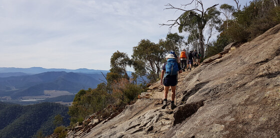
Mt Buffalo National Park offers spectacular scenery, moderately challenging walks through varying terrain, and rich diversity of flora and fauna, as well as unique geological formations. This Nomads walking and social weekend in group accommodation in Victoria's North-East is now in its ninth year, and David R. will again head up the walk leaders' team. Bookings are limited and it always books out, so book now to ensure you don't miss out!
GRADE | LENGTH | TYPE: Arriving Thursday for those joining the Friday and weekend walks, or arriving Friday for those doing the weekend walks only.
FRIDAY: For those arriving Thursday night and wishing to do the optional Friday walk. It will be a relatively hard walk on Mt Buffalo, in an area to be decided depending on weather and park conditions. Alternatively, you can have a restful day at Restaway or visit local wineries, the brewery or the Bright region.
SATURDAY: On Saturday there will be a day-walk on Mt Buffalo and the communal BBQ dinner at Restaway on Saturday evening.
SUNDAY: We plan to offer two morning options, one on the mountain finishing at the lake, and the other in the Ovens Valley and or Bright area. Both options will allow returning home on Sunday afternoon.
SAFETY POINTS:
APPAREL: Walkers must carry enough clothing and gear for all weather eventualities irrespective of the starting weather and forecast, as mountain weather can change very rapidly; you should wear comfortable walking boots or shoes and carry a minimum of a sun hat, a warm hat and a rain and wind proof jacket.
BRIEFING: Attendance at the daily briefing is a requirement and a prerequisite for participation on that day.
FUEL: Please note that there is no fuel available on the mountain; anyone driving up must have adequate supply from the valley.
ACCOMMODATION: The weekend will follow the popular formula of previous years based on accommodation at Restaway Holiday Units in Porepunkah. Accommodation is in shared holiday units, with each unit having two bedrooms (one with a queen bed, the other with 2 single beds), a living area, a bathroom and a kitchenette.
The booking for this event is for Friday and Saturday nights, and Thursday is an optional extra. The maximum number of people for the walks is 30. Depending on room options selected, Restaway accommodates about 24 people, so there is limited capacity for up to six off-site campers (e.g. local caravan park of your choice). Confirmed bookings will be on a first booked basis, booking will be closed when capacity is reached, and a wait list will be available. Cancellations will be offered in the order of wait-listed bookings.
We expect to book out all of Restaway again, so we will have exclusive use of the swimming pool, large garden and BBQ area, within walking distance of Porepunkah village.
Some may want to extend their stay at Restaway, arriving early or staying beyond Sunday. If you remain in your weekend unit (with no room service) for the duration, the owners are offering a "special whole-unit rate". Please email LeaderAlanD.thenomadsinc@mail.tidyhq.com for questions on accommodation, meals or booking, or if you wish to extend your stay.
FOOD & MEALS: Porepunkah village has only a pub and service station, and no food store so it is essential to bring all your food and drink needs with you. Bring your own breakfasts, lunches, drinks and snacks for all days. During the walks it is essential you carry your own lunch, snacks and at least 1 litre of water; no food is available on the mountain.
Dinner Thursday and Friday night: Either bring your own dinner and eat in (BBQ available on-site, and each unit has a basic kitchenette), or eat out at the local hotel. A group booking has been made for 7pm on Friday night at the Porepunkah Pub for those (almost everybody) who selected that option when getting tickets to the event.
Dinner Saturday night: Your payment includes the famous Nomads communal BBQ dinner (including meat or vegetarian option, plus dessert) on Saturday night, but BYO drinks. The organiser is coordinating with those staying at Restaway to bring pre-dinner nibbles or a small salad.
Sunday: participants will need to carry lunch.
BOOKING: To join this weekend you need to book and pay ASAP by clicking Get Tickets. Note:
(i) This is a popular event; in every previous year the event has been fully booked.
(ii) A booking can only be made through the Nomads website, and needs to include full payment; if you find it is fully booked, please take out a free WAITING LIST ticket and you will be contacted (in the order of ticketing) if there is a cancellation.
(iii) Maximum walking group size is 30, limited to ensure a quality environmental experience and individual and group safety.
(iv) The event is a mixed social and bushwalking event, based on accommodation at Restaway and walks on Mt Buffalo.
Visitors: This event is generally not open to Visitors.
Roles: The roles are being split again this year. David is organising leadership of the walks and the Saturday BBQ, while Alan is taking care of all administrative matters and enquiries.
Booking Guide: Bookings are taken in the order of registration. To book, click on Get Tickets. The Ticket includes participation in the walks, the cost of accommodation and Saturday night's BBQ dinner. Cancellations within a week of the event will only receive a refund if somebody else is able to take their place.
NIGHTS? Firstly, decide if you will be arriving on Thursday or Friday.
SHARED? Secondly, choose if you want 'Shared bedroom' accommodation, in which you will share the room with one other person (separate beds, or, share a queen bed with your partner or friend), OR, want a 'Solo room' which gives you a room for your use only.
GET TICKETS: Buy the ticket(s) you want. You will be asked to specify a number of preferences when booking:
* Bed Partner: if you are sharing your bed please name your bed partner.
* Non-bed partner: If you already know the person you wish to share your room (but not your bed) with, please list them. If you elected to share a room but haven't specified a room-mate, we will allocate a room-mate for you.
Note that a separate ticket needs to be purchased for your bed or room partner (on which they name you as their bed or room partner).
* Do you need transport to the event? If you need, or can provide, transport, please indicate your postcode also.
* Friday Dining Preference: Choose either the Porepunkah Pub group booking or else Own arrangements.
* Saturday Dietary Preference: for Saturday night: vegetarian, meat or other? (for 'other', please email the leader with your needs)
* Saturday Meal Contribution?: indicate the type of salad or pre-dinner nibble you have in mind to bring, if any. (Only one contribution per couple; off-site participants are not expected to bring any contributions).
Unsure if you've already booked? Click View my bookings.
FURTHER INFORMATION: www.parks.vic.gov.au/places-to-see/parks/mount-buffalo-national-park and www.restawayholidayunits.com.au.
MEETING TIME | LOCATION: Arrival time is from 3pm onwards on either the Thursday or Friday at Restaway Holiday Units, 6852 Great Alpine Road, Porepunkah. Car pooling arrangements from Restaway to Mt Buffalo will be organised each day at the compulsory pre-walk briefings held at Restaway prior to leaving for each day's walk.
MAP REFERENCE: Meeting point at Restaway Holiday Units: Melway map X922 grid F9 | Google map www.google.com.au/maps/place/Porepunkah+VIC+3740.
DISTANCE | TIME FROM GPO: 320 km, approximately 3 hours 30 minutes driving time, via Hume Hwy, Snow Road, Myrtleford to Porepunkah.
TRANSPORT: Car sharing or public transport is preferred - we'll try to avoid single-occupant car trips. There is a V/Line bus stop in Porepunkah, with connections to Wangaratta Station.
FOOD: See above. Bring your own food for breakfasts, lunches, drinks and snacks for all days, there is no food store in Porepunkah, only a pub and service station. During the walks you must carry your own lunch, snacks and at least 1 litre of water.
LEADER: Alan D. | Email LeaderAlanD.thenomadsinc@mail.tidyhq.com if you have any questions.
NOTE: David R (LeaderDavidR.thenomadsinc@mail.tidyhq.com) will be organising the walks and the Saturday evening meal, but please contact Alan D with any enquiries about administration of the event or requests for information.
Members can access leader contact details under Members | Leader Contacts when logged in to the website.
HOME BACK TO LIST OF EVENTS MEMBERSHIPS
Feb
10
2024
Past Event
Naturist Mixed Beach Day at Sunnyside North Beach, Mt Eliza followed by optional food or drinks at a restaurant in Frankston
Sunnyside Road
10:30 – 16:00
A leisurely day at the beach. This is a mixed event. Everybody is welcome.
GRADE | LENGTH | TYPE: Easy, social day with short walks along the beach. Some rocks to walk over to get from the carpark to the naturist beach.
ACTIVITY DESCRIPTION:
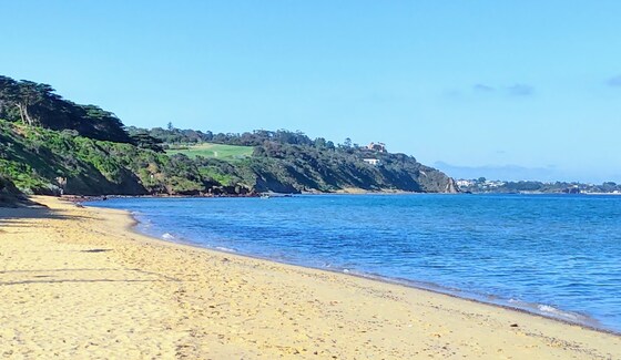
Enjoy a leisurely day sunbaking, walking, swimming and socialising with other Nomads on the beach. Sunnyside North Beach is the only officially designated clothing optional beach on Port Phillip Bay, and the closest legal naturist beach to Melbourne.
Sunnyside North Beach is a very popular beach with naturists from all over Melbourne and beyond, for very good reasons. It is a safe beach, easy to get to, and offers good swimming and general beach fun. There are a number of rocky areas and reefs close to shore which may also provide snorkelling opportunities if you wish. Most of the beach is sandy with scattered small rocks. This is a family friendly beach, so behaviour needs to be appropriate at all times.
The naturist beach is a very popular location on any sunny day, and the car parking spaces closest to the beach fill up quickly. Arrive early if you would like the best chance of a close park. However please note that the council has recently introduced paid parking in the main car park, $6.20/hr or $19.50 for all day. There are still free all-day parking spaces along the side of Sunnyside Road, but ensure that you read the parking signs carefully as parking inspectors have been known to work over the weekends.
We strongly suggest not leaving valuables visible in your car, which of course is good practice everywhere. And, as is common sense, do not leave anything unattended on the beach.
In the main beach carpark (Sunnyside Beach - clothed) are several modern individual toilets and outdoor showers, but once we move to the clothing optional beach, there are no facilities at all. You need to be self-sufficient and bring your own food and drink, esky, sun shelter or wind protection if desired, sunscreen, sunnies and hat. Clothing must be worn between the carpark and the beach. Also, we recommend suitable footwear to protect your feet from the sometimes sharp rocks along the short walking track to the beach. The leader will bring a beach shelter which can be used as a communal place to keep small items out of the direct heat of the sun, and as a focal point for our group once on the beach.
We will gather towards the Northern end of the main carpark at the end of Sunnyside Road at 10.30am. If you arrive late, no problem, just follow the rocky track north until the next sandy beach, you will have no problem locating and joining our group.
Low tide at Sunnyside North Beach will be at 10.15am (though it's not very low), and high tide is forecast for 3.00pm.
You are free to do as much or as little as you want on the beach, it is your day, so make the most of it. There is no planned finishing time, you are free to spend as much or as little time as you wish on the beach.
If the weather forecast for the day is determined as unsuitable by the leader, this beach day may be cancelled, or alternatively may be changed to the following day. Any changes in event details due to adverse weather or other reason will be made to the Nomads event listing no later than 8pm on the evening prior to the event. If no changes to the event details by 8pm, the beach day will go ahead as planned and there is no need to check further.
This is a free event, but to assist with planning, it is requested that you register your attendance. We look forward to seeing as many of you as possible on this naturist beach day.
OPTIONAL FOOD OR DRINKS AT RESTAURANT IN FRANKSTON
If you would like to extend the social atmosphere of the beach day a bit further, we are plannng to make a group booking for about 12 people at a nice restaurant in Frankston commencing at 5pm. The booking is at Iron River Bar and Grill, 437 Nepean Highway, Frankston.
Frankston is approximately a 20min drive from the carpark at Sunnyside Beach. Attendance is entirely optional, but due to the popularity of the venue, we would need to confirm numbers as early as possible on the day. If we require more seats reserved for us, a change of booking at the restaurant can be requested, but there are no guarantees, as they are often fully booked.
If you think that you might like to come along for food or drinks after the beach day, please contact the leader via the link in this event information. No obligation, just helps with planning.
BOOKING: Preferably by Thursday, 8th February 2024. To register to attend, click on Get Tickets (no charge for this event).
Unsure if you've already booked? Click View my bookings.
FURTHER INFORMATION: www.melbourneplaygrounds.com.au/sunnyside-beach-mount-eliza#.XVd7kOgzZPY.
MEETING TIME | LOCATION: 10.30am at the Northern end of the main beach carpark at the end of Sunnyside Rd, Mt Eliza.
MAP REFERENCE: Melway map 104 grid K5 | Google map goo.gl/maps/ggsox7nN4KDiCa5z9.
DISTANCE | TIME FROM GPO: 66 km, 1 hour 10 minutes via M1 and M3 | 79 km, 1 hour 20 minutes via M3.
PUBLIC TRANSPORT: From Flinders Street Station, catch the 8:23am Frankston train to Frankston, arriving at 9:28am. The 785 bus departs from Bay D at Frankston Station at 9:40am. Get off at the George Vowell Institute Blind/Nepean Hwy, Mt Eliza at 9:55am. From there it is a 1.3 km walk to the Sunnyside Beach car park. Alternatively, contact the leader, who may be able to arrange car sharing for you.
FOOD: Lunch, snacks, plenty of water/drinks as there are no local facilities immediately available.
LEADER: Michael J. | Email the Leader if you have any questions.
Members can access leader contact details under Members | Leader Contacts when logged in to the website.
HOME BACK TO LIST OF EVENTS MEMBERSHIPS
Feb
06
2024
Past Event
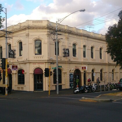
Monthly Social Night - Great Northern Hotel
Great Northern Hotel
19:00 – 21:00
Our regular monthly social night - this month at the Great Northern Hotel, Carlton North.
GRADE: Social.
ACTIVITY DESCRIPTION: Join us for our monthly social evening where members can enjoy a meal, talk about upcoming events, compare notes on past activities and float ideas on events they would like to see run.
Tuesday evening at the Great Northern is Steak Night: "The steaks are cooked to your liking, served with chips and salad and your choice of sauce. With the frequent alternative of porterhouse or scotch, the Tuesday steak night is great value.". See the Great Northern Hotel Menu for other options.
BOOKING: By Monday 5th February. To register, click on Get Tickets.
Unsure if you've already booked? Click View my bookings.
MEETING TIME | LOCATION: 7pm at the Great Northern Hotel, 644 Rathdowne St, Carlton North.
MAP REFERENCE: Melway map 29 grid K11 | Google map maps.app.goo.gl/pYvbKURbR9psW2Sq8.
PUBLIC TRANSPORT: Tram #1 or #6 to stop 118 (Pigdon St/Lygon St).
LEADER: Garry O. | Email LeaderGarryO.thenomadsinc@mail.tidyhq.com if you have any questions.
Members can access leader contact details under Members | Leader Contacts when logged in to the website.
HOME BACK TO LIST OF EVENTS MEMBERSHIPS
Feb
04
2024
Past Event
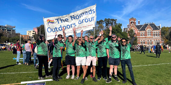
The Nomads at Midsumma Pride March
Ian Johnson Oval
09:30 – 16:00
Gather your friends together, and your Nomads polo shirt, and head along to Fitzroy St, St Kilda to march with The Nomads in the annual Midsumma Pride March.
GRADE | TYPE: Easy, social.
ACTIVITY DESCRIPTION: Come along to march with us, or cheer us on from the sidelines.
The best view of the parade is always from within it though, so register via Get Tickets to join The Nomads in marching proudly down Fitzroy Street.
See the Midsumma Pride March event closer to the date for comprehensive details.
BOOKING: By Friday 2nd February. To register, click on Get Tickets.
Unsure if you've already booked? Click View my bookings.
MEETING TIME | LOCATION: probably 9:30am - we will be notified of our assembly time closer to the event | Ian Johnson Oval, Fitzroy St, St Kilda.
MAP REFERENCE: Melway map 2P grid B3 | Google map goo.gl/maps/rNZFmL1Pz16aCqD18.
PUBLIC TRANSPORT: 12 to stop 143 | tram 96 to stop 132 | any St Kilda Rd tram to stop 30 (these tram stops will be serviced even while the march is proceeding).
LEADER: Garry O. | Email LeaderGarryO.thenomadsinc@mail.tidyhq.com if you have any questions.
Members can access leader contact details under Members | Leader Contacts when logged in to the website.
Image: Zack M.
HOME BACK TO LIST OF EVENTS MEMBERSHIPS
Feb
03
2024
Past Event
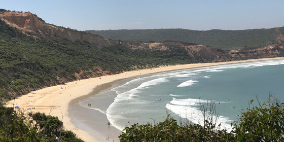
SouthSide Naturist Beach Day with optional dinner.
Southside Beach
10:30 – 16:30
Fully booked for Local Private BBQ Event after beach activities.
This event is for naturists. Enjoy a pleasant clothes free beach day, enjoying games, swim and socialising. An optional naturist beach walk during the day with an optional BBQ dinner and spa (clothes free event) at a private residence is also on offer.
GRADE | LENGTH | TYPE: Easy, approximately 400m walk from the car park to the beach. There is a ramp down to the beach which is a rather step in parts. Beach walk is graded easy subject to tides.
ACTIVITY DESCRIPTION: Enjoy a pleasant clothes-free beach day, with a leisurely lunch and swim. Optional activities include body surfing in a moderate surf and a 1 km beach walk to the rocky headland towards Southside. As the tide will go out during the day, we could if you like walk around the headland for another kilometre to the very end of the naturist beach at Pt Addis. A beach game or two will also be enjoyed.
At the conclusion of the walk, all participants are invited to a clothes-free BBQ dinner and spa at a Nomads private house in Torquay. Bring your own drinks and alcohol (responsible consumption), food will be provided as part of the cost of the event. Bring 2 towels and thongs for those attending the BBQ dinner.
BOOKING: By Friday 2nd February. To register, click on Get Tickets.
Unsure if you've already booked? Click View my bookings.
MEETING TIME | LOCATION: 10:30am at SouthSide car park. Google "Southside car park" for the exact location. If you arrive later, you can meet us on the beach proper. Instructions will be emailed prior to the event on the exact spot if you wish to join later.
MAP REFERENCE: Melway map X911 grid E9 | Google map maps.app.goo.gl/DaoEh41aTQkm5U5N6.
DISTANCE | TIME FROM GPO: 107 km, approximately 1 hour 20 minutes to drive via the M1 freeway.
PUBLIC TRANSPORT: The Apollo Bay coach has a stop at Pt Addis Rd, from Geelong but it is strongly encouraged not to use public transport. Carpooling is an option for those without a car, please make your own arrangements. Contact the leader well in advance if you do not have a nominated driver if a driver can be arranged.
FOOD: Bring lunch, snacks and drinking water. There is no kiosk facilities at the beach.
APPAREL | FOOTWEAR: Sunscreen, hat, repellent, beach towel, footwear if the sand is hot. Shorts required to get from the car park to the appropriate clothing option section of the beach. Beach umbrella or shade equipment could be useful as there is limited shade at the beach. Please bring two towels if you wish to attend the BBQ dinner option.
LEADER: Jason T. | Email LeaderJasonT.thenomadsinc@mail.tidyhq.com if you have any questions.
Members can access leader contact details under Members | Leader Contacts when logged in to the website.
HOME BACK TO LIST OF EVENTS MEMBERSHIPS
Jan
28
2024
Past Event
Midsumma Walk: Nomads Treasures of the Garden State
Carlton Football Club
10:30 – 17:00
Enjoy Inner Melbourne from a different perspective.
GRADE | LENGTH | TYPE: Easy point-to-point 8 km walk on sealed and packed gravel surfaces, with no real hills.
ACTIVITY DESCRIPTION: The proposed route for the 2024 Midsumma community walk is from the Carlton Football Ground (tram route #19) to the Botanic Gardens (lots of public transport exit options) via Melbourne Cemetery, Carlton Gardens, Treasury/Fitzroy Gardens, Yarra Park and via Goschs Paddock into the Botanic Gardens. The walk will include checking out major buildings along the route - such as the Exhibition Building, Eastern Hill Fire Station, etc.
BOOKING: By Friday 26th January. To register click on Get Tickets.
Unsure if you've already booked? Click View my bookings.
MEETING TIME | LOCATION: 10:30am near city-bound tram #19 stop 16 on the corner of Walker Street and Royal Parade. This is outside the Carlton Football Club, Ikon Park, 400 Royal Parade, Carlton North. There is parking available, but public transport is recommended to get to the starting point, otherwise you'll need to use public transport to return to your car after the walk.
MAP REFERENCE: Melway map 29 grid G12 | Google map maps.app.goo.gl/814zzg2PZaK8pSE57
PUBLIC TRANSPORT: Tram #19 to stop 16 (Walker St/Royal Pde, also referred to as Visy Park/Royal Pde). The #19 tram that departs from the terminus at the corner of Flinders St and Elizabeth St at 10:07am is scheduled to arrive at stop 16 at 10:23am.
FOOD: Carry lunch, snacks and a litre of water.
APPAREL | FOOTWEAR: Comfortable walking boots/shoes and dress according to the weather forecast.
LEADER: Garry O. | Email LeaderGarryO.thenomadsinc@mail.tidyhq.com if you have any questions.
Members can access leader contact details under Members | Leader Contacts when logged in to the website.
HOME BACK TO LIST OF EVENTS MEMBERSHIPS
Jan
26
2024
Past Event
Australia / Rum Rebellion Day at Blanchfields 26 January
12:00 – 16:00
Enjoy a casual picnic on 26 January on the property of a Macclesfield member, which includes a swimming pool, expansive outdoor picnic area, historic features and some delightful walking trails.
GRADE | LENGTH | TYPE: Social - picnic with optional camp out overnight at "Blanchfields", a private home overlooking the Yarra Valley.
ACTIVITY DESCRIPTION: We are very privileged to be invited to a picnic in the private and beautiful gardens of the home of member Robert A. It is a rural property with a large garden of exotic trees and shrubs, grasslands and some bushlands overlooking the Yarra Valley. Robert has also invited guests to stay the night after the day of revelry if you wish. You are welcome to set up your tents or trailers in the gardens and leave the next day. In that case, Robert will direct you where you can set up camp.
The event starts from midday onwards. There are a limited number of chairs and tables as well as a toilet and bathroom for use. Note – this is not a barbeque. Fires are not allowed in a high fire danger area. Enjoy the swimming pool and stay over in your tent or camper if you wish. There will be access to the oven/stove if anything needs cooking or heating up. Plus, the vegetable garden should be in full production if we need additional ingredients. Updates will follow closer to the date. There will be a short walk around the property later in the afternoon.
BOOKING: by Tuesday 23rd January. To register, click on Get Tickets.
Unsure if you've already booked? Click View my bookings.
MEETING TIME | LOCATION: From midday onwards at the private home of member Robert A., located in Macclesfield (past Emerald). Address will be forwarded once you have booked a ticket.
MAP REFERENCE: Melway map X912 grid R4 | Google map goo.gl/maps/KBZiiJpW2uj.
DISTANCE | TIME FROM GPO: 1 hour – about 60 km.
TRANSPORT: No public transport. Travel by car and carpool with someone else if you can. Take the Monash or Eastlink Freeway and exit at Wellington Rd then continue to Macclesfield. The full address and travelling directions will be provided to you upon receipt of your RSVP.
FOOD: Bring your own food and drink. For those staying the night, there will be shared drinks, nibbles and meal on the deck at sunset. Until we know how many will be taking part, let’s just call it a “potluck dinner”, any contributions gratefully received.
APPAREL | FOOTWEAR: Bring your own hat, sunscreen and insect repellent. Dress according to the weather forecast.
LEADER: Robert A. | Email LeaderRobertA.thenomadsinc@mail.tidyhq.com if you have any questions.
Members can access leader contact details under Members | Leader Contacts when logged in to the website.
HOME BACK TO LIST OF EVENTS MEMBERSHIPS
Jan
20
2024
Past Event
Mixed Naturist Walk at Deep Creek Chintin
Open House Cafe
10:15 – 16:00
This event is now fully booked with 34 walkers registered as at 12 noon Friday 19th Jan, and bookings have now closed.
The next naturist hike is scheduled for Sun 18th Feb to Carrolls Spring and the Upper Werribee River. We are meeting in Ballan.
Also there are also two naturist beach days scheduled in early February.
____________________________
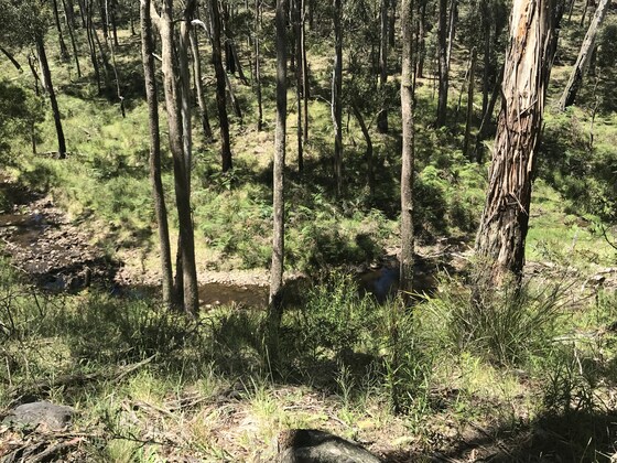
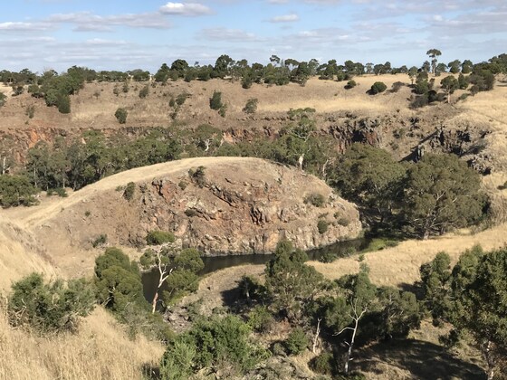
A medium (sometimes hard) grade naturist walk through a remote and spectacular gorge north of Melbourne following along the banks of a significant creek. We will stop for a relaxed lunch and swimming breaks at some pleasant waterholes.
GRADE | LENGTH | TYPE: A medium to hard grade walk including a couple of moderate climbs. It is approximately 6 km in length. For quite a bit of the walk there is a small track through the gorge. At other times we are stepping across bluestone river rocks. There are 4 creek crossings where we will use wooden poles to assist us. The walk to the top of the valley is a rarely used 4WD track and along the top of the escarpment is quite a nice kangaroo pad. Approximately 3 hours walking time plus 1.25 hrs lunch and swim stops.
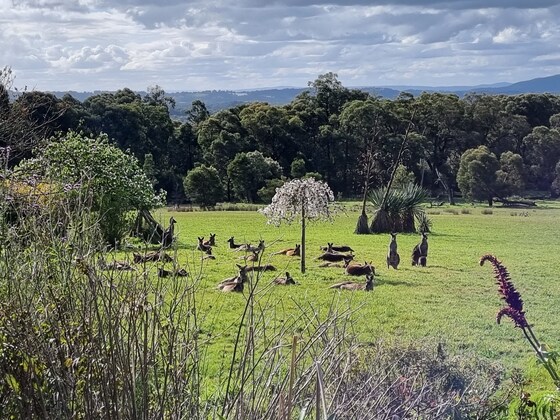
ACTIVITY DESCRIPTION: This walk is for naturists. Stroll down to the valley of Deep Creek and view the spectacular rock walls along the side of this valley. It is in an unexpectedly remote area of the countryside and appears not to have been visited by anyone for a very long time. The waterholes are wonderful, deep with crystal clear water and they appear to last well until the end of summer! Deep Creek is one of the main tributaries to the Maribyrnong River. Along the river course are beautifully large and shady river red gums. Enjoy the atmosphere in this relatively unknown ravine. A good chance you'll see a kangaroo or two as well. Back at the cars by 4pm approx. This spot is 20 minutes (18 km) from Wallan.
BOOKING: Preferably by Wednesday 17th January. However these events are often booked out a week in advance. So if you'd like to come along, book early. It's much easier to cancel if you can't come, than be waiting on a Waitlist.
To register, click on Get Tickets. Unsure if you've already booked? Click View my bookings.
MEETING TIME | LOCATION: 10:15am for a morning coffee and catch up at Open House Cafe, Shop 4/51 High St, Wallan. Hopefully there is enough parking in front of the shop. If not you can park across the road in the carpark for the reserve. The cafe is quite large and offers a good breakfast menu. Arrive early if you'd like some, so that you have time to enjoy it.
10.45am. The day's briefing and car pooling arrangements outside the shop. From the cafe to the start of the walk is 18km which will take 20 mins to drive. The exact location in Chintin will be emailed to attendees 2 days before the event.
MAP REFERENCE: Melway map 646 grid A10 | VicRoads map 60 grid H8 and map 638 grid D8 | Google map: maps.app.goo.gl/F1H8ss7jrN4vGD4n9
DISTANCE | TIME FROM GPO: 60 km, 1 hour.
PUBLIC TRANSPORT: There is no suitable public transport to our meeting place on Sunday mornings. Please contact the leader Russell at least 3 days before the event so that we can arrange a lift from Melbourne for you. You can email Russell on LeaderRussellW.thenomadsinc@mail.tidyhq.com Transport back to Melbourne should be no problem as many cars are coming back at various times.
AFTER-WALK REFRESHMENTS: For those who would like some cool drinks, coffee or snacks after the walk we will be returning to a Wallan cafe, Vento Cafe Bar & Restaurant. It's in the Shopping Centre at 81 - 89 High St Wallan. It's on the southern end (Melbourne end) of the shopping Centre, and on your right hand side as you enter the main doors of the Shopping Centre. If you're in the mood you can stay on for dinner.
APPAREL | FOOTWEAR: Sunscreen, hat, dark glasses, comfortable walking boots/shoes, towel to dry off after swimming/paddling. Shorts or similar could be required when we walk from the cars 1/2 km to the gorge.
FOOD: Carry lunch and snacks. Most people take at least 600ml to 1 litre of water, though some people need more, especially if the weather is hot.
COST: Nomads financial members free, non-financial members $5.
LEADER: Russell W. | Email LeaderRussellW.thenomadsinc@mail.tidyhq.com if you have any questions.
Members can access leader contact details under Members | Leader Contacts when logged in to the website.
HOME BACK TO LIST OF EVENTS MEMBERSHIPS
Jan
14
2024
Past Event
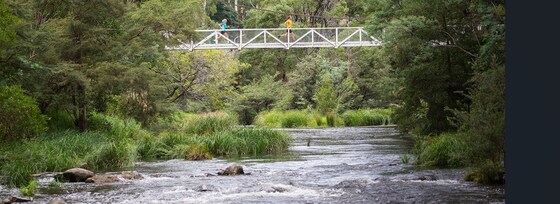
Warburton River & O'Shannassy Aqueduct Walk
The Warburton Bakery
11:15 – 16:00
A circuit walk east of Melbourne.
GRADE | LENGTH | TYPE: Medium 7 km circuit walk. Total rise 270m.
ACTIVITY DESCRIPTION: Explore this 7 km loop trail near Warburton, Victoria. Generally considered a moderately challenging route.
This mixes together sections of various routes to create a loop that circles around Warburton. A great sampler of some routes which are much longer. Super steep start up a section of the Donna Buang Trail. Then along a section of the Aqueduct trail to Donna Buang Road, then back down towards the village along the Yarra River bank.
The Yarra Ranges is home to the world's tallest flowering tree, the Mountain Ash, which towers over lush tree ferns and mossy Myrtle Beech.
The track can get muddy after the rain, so be sure to set out with good footwear if there's been recent rainfall.
BOOKING: By Friday 12th January. To register, click on Get Tickets.
Unsure if you've already booked? Click View my bookings.
MEETING TIME | LOCATION: 11:15am at Warburton Bakery, 3415 Warburton Highway, Warburton.
PUBLIC TRANSPORT: 9:06am Lilydale train from Flinders St Station to Lilydale 10:15am, then bus #683 at 10:22am, arriving at Warburton at 11:08am. We'll organise a lift back to Lilydale or other suitable station.
MAP REFERENCE: Melway map 290 grid B4 | Google map goo.gl/maps/63zB7PpYQEzBbJ6b9.
FOOD: Carry lunch, snacks and a litre of water.
APPAREL | FOOTWEAR: Comfortable walking boots and dress according to the weather forecast.
LEADER: Richard C. | Email LeaderRichardC.thenomadsinc@mail.tidyhq.com if you have any questions.
Members can access leader contact details under Members | Leader Contacts when logged in to the website.
HOME BACK TO LIST OF EVENTS MEMBERSHIPS
Jan
13
2024
Past Event
**CANCELLED** Men's Only Naturist Beach Day at Somers & Men's only Naturist drinks at Bittern
Somers Beach
10:30 – 15:30
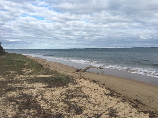
Enjoy a relaxed day out at the Somers naturist beach.
PLEASE NOTE: Running naturist outdoor events near Melbourne, Victoria can be quite risky weatherwise. Should we not get a pleasant warm, sunny day on Sat 13th Jan the event will be postponed to a later date.
GRADE | LENGTH | TYPE: Easy 7 km circuit walk. It is a pleasant 3.5 km walk along the beach from the car park in Somers towards Sandy Point to a good setup place in the sand dunes. The sand is fairly firm. Walking time is generally about 55 minutes to the setup place. Most of the beach walk can be done minus clothes once we get past the local dog walkers close to Somers. Of course it is another approx 3.5 km back to the cars at the end of the day.
ACTIVITY DESCRIPTION: This event is for naturists. Enjoy a pleasant relaxing beach day - walk, swim and sunbake with other fellow naturists.
After the beach we have been invited to a men's naturist drinks at a fellow nudist's residence in Bittern, 10 minutes drive away. (Apologies, the afternoon tea is a men's-only gathering).
BOOKING: By Thursday 11th January. To register, click on Get Tickets.
Unsure if you've already booked? Click View my bookings.
MEETING TIME | LOCATION: 10.30am in the car park at 121 Miramar Rd, Somers.
There is no cafe near the meeting place sorry, you will need to bring your coffee with you. (You can get coffee in Bittern at Remuce Cafe or the Bittern Bakery and Cafe).
We plan to depart from the car park for the beach at about 11am. If you should miss us, or wish to come at a different time, walk to the side of the car park nearest the beach and go down the steep steps to the beach. At the bottom of the stairs turn left and walk for about 55 minutes and you should find our camp.
Food Drop off in the Morning: If you'd like to drop off food before you come to the beach, you may drop it at the house in Bittern between 9.45am and 10.15am. The house is 1 hour 20 minutes, and 82 km from Melbourne - a long way! Make sure you plan your time. From the house to the meeting place it is a 10 minute drive.
Address of the Afternoon Tea House: This will be emailed to all those who have booked by 10pm on Thursday 11th January. It will also be given out on the beach day.
TIDE FORECAST: Best suited to our needs Low 10.30am 1.7 - 1.8mt- High 3:30pm 2.3- 2.4mt. The tide may be getting up when we leave from the carpark for the beach starting to getting lower when we leave the beach to come back in the afternoon. (For those who haven't been to Somers, it can be quite difficult to climb over the fallen trees on the beach if high tide is fully up. On this occasion we are not at max tides).
MAP REFERENCE: Melway map 194 grid F11 | Google map goo.gl/maps/6AUdGMw3E9BwtP38A.
DISTANCE | TIME FROM GPO: 86 km, about 1 hour 20 minutes to 1 hour 30 mins depending on which route you take.
FOOD:
FOOD and BEVERAGES for the BEACH DAY: Carry lunch, water and any other food/drinks you may like for the beach day.
FOOD and DRINKS for the AFTERNOON: Please bring some food to share for afternoon at the Bittern residence after the beach day. Tea and coffee will be provided. Bring cold drinks if you would prefer those.
APPAREL: Sunscreen, hat, sun glasses, footwear if the sand is hot. Shorts required to get from car park to the naturist beach.
EQUIPMENT: Towel. A picnic blanket with plastic backing or a large plastic sheet is handy, because in some places the grass seeds stick tightly to your towel and are very hard to get out. You may wish to bring a sun shelter. The tea tree provides quite good, but not complete, shade cover. Sporting equipment such as a frisbee, tennis ball, larger ball, small cricket bat etc. could be fun.
LEADER: Peter H. | Email LeaderPeterH.thenomadsinc@mail.tidyhq.com if you have any questions.
Members can access leader contact details under Members | Leader Contacts when logged in to the website.
HOME BACK TO LIST OF EVENTS MEMBERSHIPS